Me: Bill Morris
- Cartographer at Faraday Inc

Me: Bill Morris
using turf.js for spatial data crunching
Plan:
GIS + the internet: a lightning history
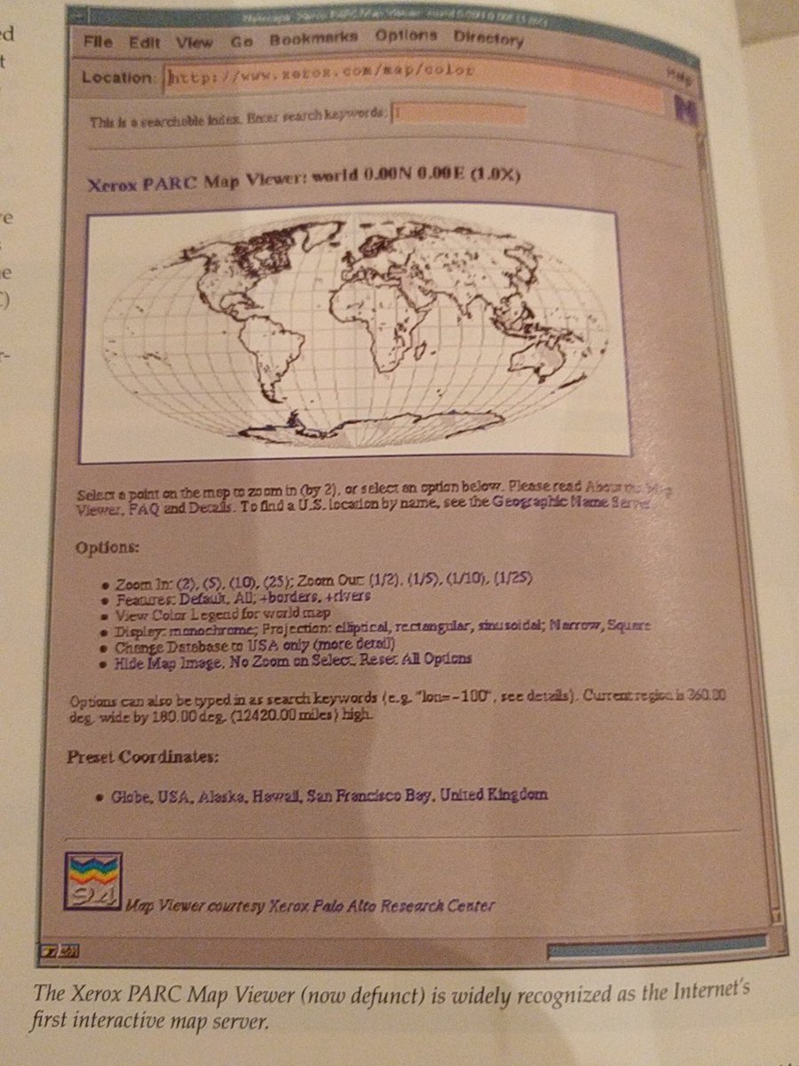
1993: Xerox PARC
~2000:

2004: Complexity increases
2005: Year G
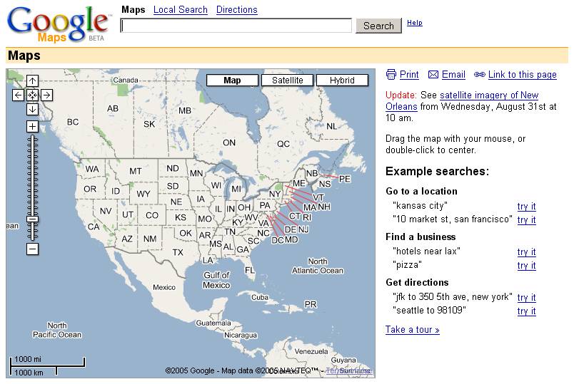
[a.k.a. Year of The Tile, a.k.a. The Resurrection of Gerardus]
"GIS in the browser"
2010:
 via Dave Bouwman

2016:
It's actually a thing:
Powered by turf.js
A javascript library for live, client-side geoprocessing
Instead of this:
This:

Javascript

function bidenize() {
  document.getElementById('topbar').innerHTML = 'Random Biden quote'
}
GeoJSON
Looks like this in a text editor:
{
  "type": "Feature",
  "properties": {
    "marker-color": "#ab4ca9",
    "marker-size": "large",
    "marker-symbol": "town-hall",
    "name": "Vermont State Capitol"
  },
  "geometry": {
    "type": "Point",
    "coordinates": [
      -72.5805115699768,
      44.26252006240964
    ]
  }
}
Looks like this in a web browser:

Let's do a quick project, starting with data creation:

Then we bring the data over to dropchop and do some basic turf geoprocessing on it:

Could you spot the server in there?
Again, GIS in the web browser. LOL.

What do end users care about geoprocessing?
Geoprocessing as part of a layperson's user experience:
Nearest neighbor: Post-swimming brews

(Working from Vermont data and some good documentation)
Distance along a line: Meet me halfway

Buffering: Race route water fountains
 via Morgan Herlocker
node.js is javascript, just built for servers. turf works the same way when used as a server-side tool
But . . .

A more complicated problem, wth bigger data, needs more power than a browser can provide.
 via Stevage
 via Alex Barth
 via Morgan Herlocker
Resources to get you started:
Questions?
Hit me up:

 via
via  via
via  via
via 